 |   | | |
 | |||
 | |||
 |
Welcome To Semsons Blog
Monday, November 20, 2006
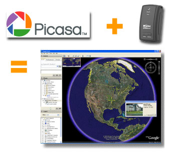 If you own a GPS data logger and a digital camera, you can have more fun with your photos by display them on Google Earth. How to do this? This is done by writing the latitude, longitude, altitude and photo direction to the image's EXIF headers to permanently embed the location data within the actual image (geotag). Google's Picasa V2.5 now includes geotag function to combine your photos with recorded tracks from your data logger and display both on Google Earth at the same time. If you own a GPS data logger and a digital camera, you can have more fun with your photos by display them on Google Earth. How to do this? This is done by writing the latitude, longitude, altitude and photo direction to the image's EXIF headers to permanently embed the location data within the actual image (geotag). Google's Picasa V2.5 now includes geotag function to combine your photos with recorded tracks from your data logger and display both on Google Earth at the same time. Labels: Data Logger, digital cameras, geotag, Google Earth, Google Map, GPS, Photo, Picasa, Semsons, Tips by: Semsons 0 Comments  
Friday, November 17, 2006
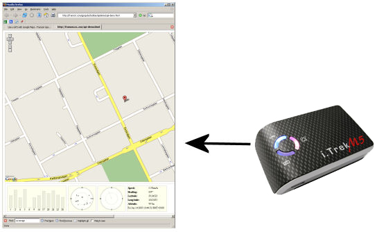 With every i.Trek GPS purchase from Semsons, one license of GpsGate is included. Besides working as a virtual com port utility which shares one GPS with multiple applications, Franson recently release a new Windows plug-in which can connect Google Map to i.Trek GPS. With every i.Trek GPS purchase from Semsons, one license of GpsGate is included. Besides working as a virtual com port utility which shares one GPS with multiple applications, Franson recently release a new Windows plug-in which can connect Google Map to i.Trek GPS.You can now view satellite status and track your location with Google Map right from your browser without purchasing any mapping software. Labels: Google Map, GPS, GPSGate, i.Trek, Semsons, Tips by: Semsons 0 Comments
 Thanksgiving is just around the corner. If you are using Odyssey Mobile, the folks at InfoGation have created a new Thanksgiving Skin for your viewing pleasure. Whether you are going to Black Friday shopping or just a visit back to your family, travel in style with Odyssey Mobile. Thanksgiving is just around the corner. If you are using Odyssey Mobile, the folks at InfoGation have created a new Thanksgiving Skin for your viewing pleasure. Whether you are going to Black Friday shopping or just a visit back to your family, travel in style with Odyssey Mobile.Labels: infogation, Odyssey Mobile, Semsons, Software, thanksgiving, Tips by: Semsons 0 Comments
 Many of you may own a GPS data logger such as RoyalTek RBT-1100, RBT-3000, or Garmin handheld. However, you can only view recorded tracks with software provided by the manufacturer. With LOGConv by Benoît, you can now convert your tracks and dispay them on Google Earth with real satellite images. Both Windows and Pocket PC are supported. Many of you may own a GPS data logger such as RoyalTek RBT-1100, RBT-3000, or Garmin handheld. However, you can only view recorded tracks with software provided by the manufacturer. With LOGConv by Benoît, you can now convert your tracks and dispay them on Google Earth with real satellite images. Both Windows and Pocket PC are supported. Labels: benoit, Data Logger, garmin handheld, Google Earth, GPS, Logconv, rbt-1100, rbt-3000, royaltek, Semsons, Software, Tips by: Semsons 0 Comments
|
Previous Posts
Archives
|

| Copyright 2007 Semsons.com All rights reserved. |
Home |
