 |   | | |
 | |||
 | |||
 |
Welcome To Semsons Blog
Tuesday, April 29, 2008
 Sharing photos online has long been a popular practice and is utilized by many users on the web. Thanks to the advancement of technology, the Amod AGL3080 GPS Data Logger takes photo sharing to a whole new level. When you take a digital picture, your camera records the date it is taken, but it’s up to you to remember where the picture was taken. This memory game can be a real pain if you were to go on a road trip or backpacking through someplace you’ve never been before. But with an Amod AGL3080 GPS Data Logger, it can record the place where the photo was taken and geotag it to allow you to see the location of the picture on Google Map or other online maps (a photo tagging software—Windows and Mac compatible—is included). Sharing photos online has long been a popular practice and is utilized by many users on the web. Thanks to the advancement of technology, the Amod AGL3080 GPS Data Logger takes photo sharing to a whole new level. When you take a digital picture, your camera records the date it is taken, but it’s up to you to remember where the picture was taken. This memory game can be a real pain if you were to go on a road trip or backpacking through someplace you’ve never been before. But with an Amod AGL3080 GPS Data Logger, it can record the place where the photo was taken and geotag it to allow you to see the location of the picture on Google Map or other online maps (a photo tagging software—Windows and Mac compatible—is included). The Amod doesn’t need drivers to operate because once plugged into the USB port, it appears as an external drive. Built using SiRF III chipset, this GPS data logger offers the best sensitivity and low speed tracking. The 128MB storage allows over 70 hours of continuous log (or 256,000 data records), and with 3 AAA batteries, the Amod AGL3080 can run for over 15 hours. As for system compatibility, this user-friendly data logger works with Windows, Mac, or Linux based computers. For help on geotagging pictures, visit “How to use Amod AGL3080 with MacBook”. Labels: AAA battery, Amod, Data Logger, geotag, Google Earth, Google Map, GPS, Mac, SiRF Star III by: Semsons 2 Comments  
Friday, August 24, 2007
 TR-102 is the latest GPS tracker from GlobalSat. It supports GSM/SMS/GPRS communication which works virtually everywhere in the world. A professional call center program is included for tracking up to 5 sets of TR-102. The location can also be displayed through Google Map. TR-102 is the latest GPS tracker from GlobalSat. It supports GSM/SMS/GPRS communication which works virtually everywhere in the world. A professional call center program is included for tracking up to 5 sets of TR-102. The location can also be displayed through Google Map.For professional application, the optional GpsGate Server can track up to 500 vehicles in real time using Google Maps or your own custom map using provided map control. Labels: call, Globalsat, Google Map, GPS tracker, GPSGate, Semsons, TR-102 by: Semsons 1 Comments
Monday, November 20, 2006
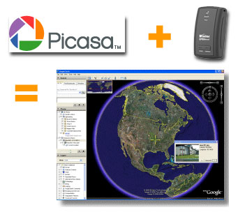 If you own a GPS data logger and a digital camera, you can have more fun with your photos by display them on Google Earth. How to do this? This is done by writing the latitude, longitude, altitude and photo direction to the image's EXIF headers to permanently embed the location data within the actual image (geotag). Google's Picasa V2.5 now includes geotag function to combine your photos with recorded tracks from your data logger and display both on Google Earth at the same time. If you own a GPS data logger and a digital camera, you can have more fun with your photos by display them on Google Earth. How to do this? This is done by writing the latitude, longitude, altitude and photo direction to the image's EXIF headers to permanently embed the location data within the actual image (geotag). Google's Picasa V2.5 now includes geotag function to combine your photos with recorded tracks from your data logger and display both on Google Earth at the same time. Labels: Data Logger, digital cameras, geotag, Google Earth, Google Map, GPS, Photo, Picasa, Semsons, Tips by: Semsons 0 Comments
Friday, November 17, 2006
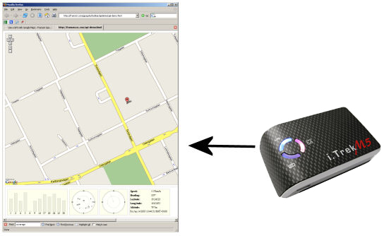 With every i.Trek GPS purchase from Semsons, one license of GpsGate is included. Besides working as a virtual com port utility which shares one GPS with multiple applications, Franson recently release a new Windows plug-in which can connect Google Map to i.Trek GPS. With every i.Trek GPS purchase from Semsons, one license of GpsGate is included. Besides working as a virtual com port utility which shares one GPS with multiple applications, Franson recently release a new Windows plug-in which can connect Google Map to i.Trek GPS.You can now view satellite status and track your location with Google Map right from your browser without purchasing any mapping software. Labels: Google Map, GPS, GPSGate, i.Trek, Semsons, Tips by: Semsons 0 Comments
|
Previous Posts
Archives
|

| Copyright 2007 Semsons.com All rights reserved. |
Home |
